Annapurna II (7937m)
5يقع Annapurna II على ارتفاع 7937 متر في Nepal, جزء من Himalayas, Asia. تُصنّف هذه القمة على أنها Fold Mountain.
Annapurna II forms the eastern anchor of the Annapurna massif in north-central Nepal and reaches 7,937 metres, a substantial peak in its own right rather than a mere satellite of Annapurna I. It rises well to the east of the main summit, separated from it by a long, complex connecting ridge. A Himalayan fold mountain, it was first climbed in 1960 by a joint British, Indian, and Nepalese party. The site rates it grade 5, an extreme classification calling for a full expedition and supplemental oxygen. Its considerable height and heavily defended ridgelines keep ascents infrequent and largely the preserve of experienced mountaineers.

On this page
مقارنة الارتفاعات
عن هذا الجبل
Annapurna II (7937m) is a fold mountain in the Himalayas, Nepal. Grade 5/5: extreme expedition where supplemental oxygen is typically required. Formed by tectonic compression, it displays layered rock strata typical of fold ranges.
المسارات
الظروف الموسمية
تحليل طبوغرافي
خريطة كنتورية
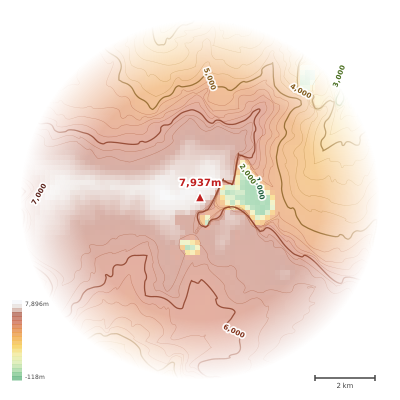
The topographic contour map of Annapurna II (7937m) in the Himalayas shows elongated parallel contours following the ridge axis. Contour lines are drawn at 100m intervals, with index contours (thicker lines) every 500m. The hypsometric color scale ranges from green (lower elevations) through yellow and orange to white (highest elevations near the 7,937m summit). Above 4,500m, the estimated snow line at this latitude, contours transition to cooler tones indicating permanent snow and ice.
المخطط الارتفاعي
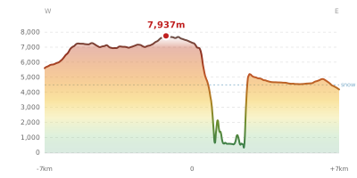
The east–west elevation profile of Annapurna II (7937m) in the Himalayas shows the terrain cross-section through the summit at 7,937m. The color gradient transitions from green (valley floor) to white (summit zone), with the red summit marker indicating the peak. The dashed blue snow line at 4,500m marks the approximate elevation above which permanent snow persists year-round.