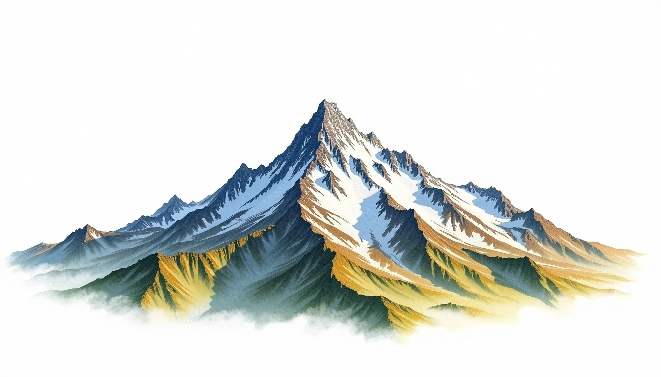
Dome de Rochefort (4015m)
Embed This Widget
Add the script tag and a data attribute to embed this widget.
Embed via iframe for maximum compatibility.
<iframe src="https://mountainfyi.com/iframe/entity//" width="420" height="400" frameborder="0" style="border:0;border-radius:10px;max-width:100%" loading="lazy"></iframe>Paste this URL in WordPress, Medium, or any oEmbed-compatible platform.
https://mountainfyi.com/entity//Add a dynamic SVG badge to your README or docs.
[](https://mountainfyi.com/entity//)Use the native HTML custom element.
Dome de Rochefort, France'da 4015 metre yüksekliğe sahiptir, Alps'ın bir parçası, Europe. Bu zirve Fold Mountain olarak sınıflandırılır.
Yükselti Karşılaştırması
Bu dağ hakkında
Dome de Rochefort (4015m) is a fold mountain in the Alps, France. Grade 4/5: technical ascent requiring mountaineering skills and equipment. Formed by tectonic compression, it displays layered rock strata typical of fold ranges.
Mevsimsel Koşullar
Topografik analiz
Kontur haritası

The topographic contour map of Dome de Rochefort (4015m) in the Alps shows elongated parallel contours following the ridge axis. Contour lines are drawn at 100m intervals, with index contours (thicker lines) every 500m. The hypsometric color scale ranges from green (lower elevations) through yellow and orange to white (highest elevations near the 4,015m summit). Above 3,200m, the estimated snow line at this latitude, contours transition to cooler tones indicating permanent snow and ice.
Yükseklik profili

The east–west elevation profile of Dome de Rochefort (4015m) in the Alps shows the terrain cross-section through the summit at 4,015m. The color gradient transitions from green (valley floor) to white (summit zone), with the red summit marker indicating the peak. The dashed blue snow line at 3,200m marks the approximate elevation above which permanent snow persists year-round.