Gasherbrum II (8035m)
4Gasherbrum II находится на высоте 8035 метров в Pakistan, часть Karakoram, Asia. Эта вершина классифицируется как Fold Mountain.
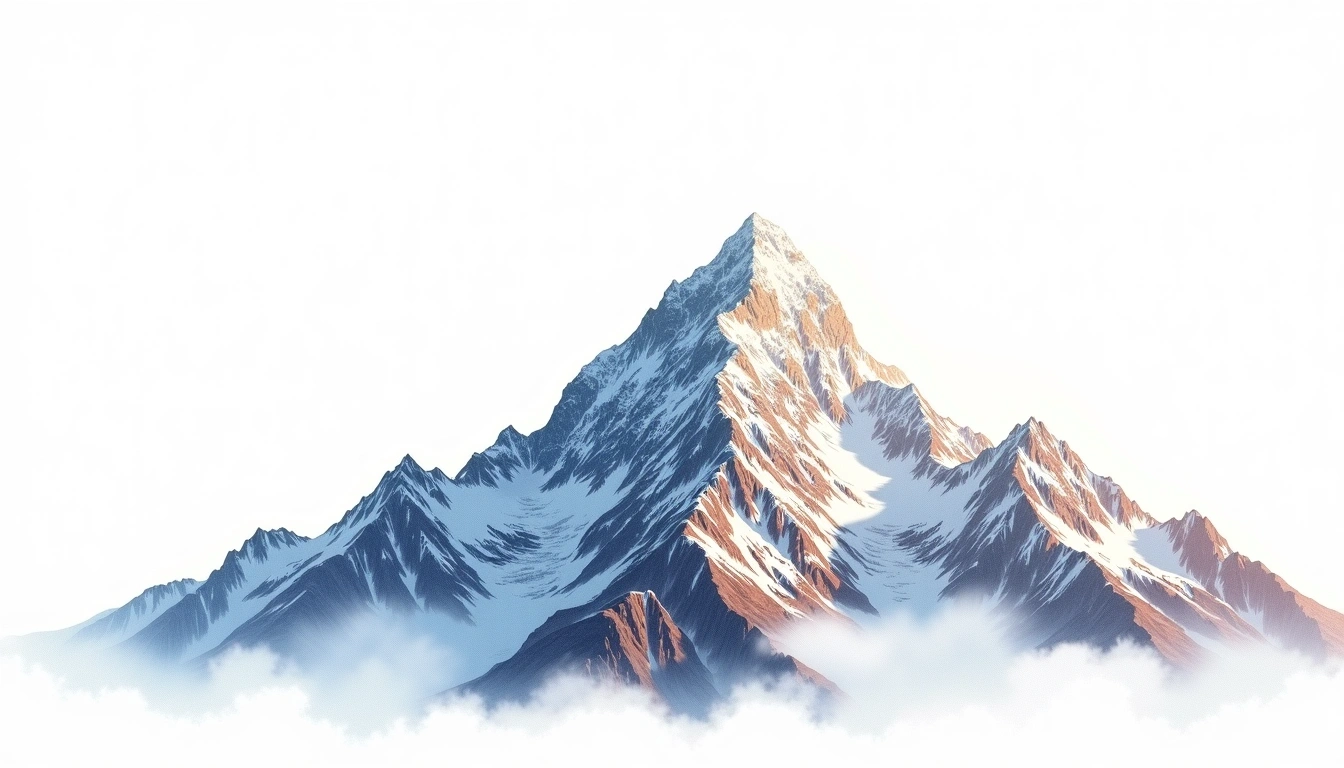
Gasherbrum II is the thirteenth-highest mountain in the world, reaching 8,035 metres in the heart of the Karakoram on the border between Pakistan and China. Second in height within the Gasherbrum group, it is widely regarded as one of the more accessible eight-thousanders and often serves as a climber's first venture above 8,000 metres. The site assigns it grade 4, a technical rather than extreme rating, reflecting slopes that, though glaciated and high, present fewer objective hazards than its neighbours. It remains a Karakoram fold peak, and its relative approachability has made it comparatively popular among the region's high summits.
On this page
Сравнение высот
Об этой горе
Gasherbrum II (8035m) is a fold mountain in the Karakoram, Pakistan. Grade 4/5: technical ascent requiring mountaineering skills and equipment. Formed by tectonic compression, it displays layered rock strata typical of fold ranges.
Маршруты
Сезонные условия
Топографический анализ
Контурная карта
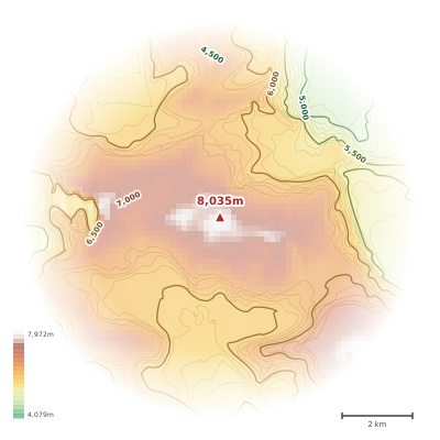
The topographic contour map of Gasherbrum II (8035m) in the Karakoram shows elongated parallel contours following the ridge axis. Contour lines are drawn at 100m intervals, with index contours (thicker lines) every 500m. The hypsometric color scale ranges from green (lower elevations) through yellow and orange to white (highest elevations near the 8,035m summit). Above 3,800m, the estimated snow line at this latitude, contours transition to cooler tones indicating permanent snow and ice.
Высотный профиль
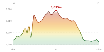
The east–west elevation profile of Gasherbrum II (8035m) in the Karakoram shows the terrain cross-section through the summit at 8,035m. The color gradient transitions from green (valley floor) to white (summit zone), with the red summit marker indicating the peak. The dashed blue snow line at 3,800m marks the approximate elevation above which permanent snow persists year-round.