Mount Shasta 3-Day Avalanche Gulch Expedition
Embed This Widget
Add the script tag and a data attribute to embed this widget.
Embed via iframe for maximum compatibility.
<iframe src="https://mountainfyi.com/iframe/entity//" width="420" height="400" frameborder="0" style="border:0;border-radius:10px;max-width:100%" loading="lazy"></iframe>Paste this URL in WordPress, Medium, or any oEmbed-compatible platform.
https://mountainfyi.com/entity//Add a dynamic SVG badge to your README or docs.
[](https://mountainfyi.com/entity//)Use the native HTML custom element.
Aperçu du terrain
Voir la montagne →
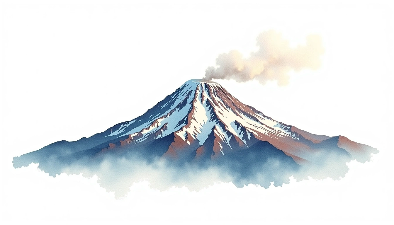
Mount Shasta (4,322m) is the largest stratovolcano in the contiguous United States by volume and one of North America's most prominent peaks. The Avalanche Gulch route is the standard ascent — a high-angle snow couloir rising from the Horse Camp base at 2,347m through Lake Helen at 3,231m and the Red Banks to the summit plateau. The 3-day format allows two acclimatization nights at Horse Camp and Lake Helen before the summit push, dramatically improving summit success rates compared to a single-day attempt from the trailhead. A Summit Pass permit is required from the USFS for all climbers above 3,048m. Crampons, ice axe, and self-arrest technique are mandatory.
Itinéraire jour par jour
Jour 1 — Day 1: Bunny Flat to Horse Camp
Short approach from Bunny Flat trailhead (2,100m) through red fir and mountain hemlock forest to the Sierra Club Horse Camp hut. Fill water from the Olberman's Causeway spring — last …
Jour 2 — Day 2: Horse Camp to Lake Helen High Camp
Ascend Avalanche Gulch through consolidated snow or volcanic scree to Lake Helen at 3,231m — the standard high camp. Tent platforms are scraped from the snow. The Red Banks headwall …
Jour 3 — Day 3: Lake Helen to Summit and Return to Bunny Flat
2 AM departure from Lake Helen. The Red Banks — 45-degree red volcanic headwall — is the technical crux requiring ice axe and solid crampon technique. Above, the Misery Hill …
Mount Shasta 3-Day Avalanche Gulch Expedition
Three-day Avalanche Gulch ascent of the Pacific Northwest's mightiest volcano — Horse Camp base, Lake Helen camp, Red Banks headwall, and the summit plateau at 4,322m.
Overview
Mount Shasta (4,322m) is the largest stratovolcano in the contiguous United States by volume and one of North America's most prominent peaks. The Avalanche Gulch route is the standard ascent — a high-angle snow couloir rising from the Horse Camp base at 2,347m through Lake Helen at 3,231m and the Red Banks to the summit plateau. The 3-day format allows two acclimatization nights at Horse Camp and Lake Helen before the summit push, dramatically improving summit success rates compared to a single-day attempt from the trailhead. A Summit Pass permit is required from the USFS for all climbers above 3,048m. Crampons, ice axe, and self-arrest technique are mandatory.
Day 1: Bunny Flat to Horse Camp
Short approach from Bunny Flat trailhead (2,100m) through red fir and mountain hemlock forest to the Sierra Club Horse Camp hut. Fill water from the Olberman's Causeway spring — last reliable water below the snowline. Set camp, check summit permits at the honor station, and acclimatize in the afternoon.
Day 2: Horse Camp to Lake Helen High Camp
Ascend Avalanche Gulch through consolidated snow or volcanic scree to Lake Helen at 3,231m — the standard high camp. Tent platforms are scraped from the snow. The Red Banks headwall looms directly above camp. Acclimatize, melt snow for water, and prepare for the pre-dawn summit push.
Day 3: Lake Helen to Summit and Return to Bunny Flat
2 AM departure from Lake Helen. The Red Banks — 45-degree red volcanic headwall — is the technical crux requiring ice axe and solid crampon technique. Above, the Misery Hill snowfield leads to the flat summit plateau. Shasta's sulfurous fumaroles confirm the volcanic nature of the peak. Descend fully to Bunny Flat before afternoon softening and rockfall.