Annapurna Circuit 14-Day Classic Trek
Embed This Widget
Add the script tag and a data attribute to embed this widget.
Embed via iframe for maximum compatibility.
<iframe src="https://mountainfyi.com/iframe/entity//" width="420" height="400" frameborder="0" style="border:0;border-radius:10px;max-width:100%" loading="lazy"></iframe>Paste this URL in WordPress, Medium, or any oEmbed-compatible platform.
https://mountainfyi.com/entity//Add a dynamic SVG badge to your README or docs.
[](https://mountainfyi.com/entity//)Use the native HTML custom element.
ภาพรวมภูมิประเทศ
ดูภูเขา →
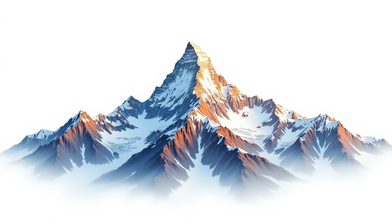
The Annapurna Circuit is one of the world's great long-distance treks, circumnavigating the entire Annapurna massif (8,091m) over 14 days. From the subtropical Marsyangdi Valley at 760m the trail climbs to the Thorong La Pass at 5,416m — the high point — before descending into the arid Mustang rain shadow via the Kali Gandaki Gorge, the world's deepest. The route crosses three distinct climatic zones and passes through Hindu, Buddhist, and Tibetan cultural regions. No technical climbing required, but the Thorong La crossing demands excellent acclimatization and fitness.
กำหนดการแต่ละวัน
วัน 1 — Day 1: Besisahar to Bahundanda
The circuit begins in Besisahar with a long, gradual walk up the Marsyangdi River valley through rice paddies and banana groves. Bahundanda ('Hill of the Brahmins') offers the first teahouse …
วัน 2 — Day 2: Bahundanda to Chamje
The river valley narrows into dramatic gorge sections with waterfalls crashing through the moss-covered rock faces. Multiple suspension bridge crossings keep the route on the most accessible bank.
วัน 3 — Day 3: Chamje to Bagarchap
The cultural transition day: Hindu villages give way to Buddhist architecture as the altitude increases. Bagarchap is the first village with Tibetan-style stone construction, mani walls, and prayer flags — …
วัน 4 — Day 4: Bagarchap to Chame
The trail climbs through pine forests and apple orchards to Chame, the district headquarters for Manang with basic shops and a TIMS checkpoint. Natural hot springs just below town provide …
วัน 5 — Day 5: Chame to Upper Pisang
Leaving the deep gorge, the valley opens dramatically. The Paungda Danda rock face — an almost vertical 1,500m cliff — dominates the view. Upper Pisang is preferable to Lower Pisang …
วัน 6 — Day 6: Upper Pisang to Manang
The upper high-route via Ghyaru and Ngawal is strongly preferred for its panoramic Annapurna views and the spectacular Braga Monastery (500+ years old). Manang is the last major settlement before …
วัน 7 — Day 7: Acclimatization Day in Manang
Rest day with mandatory altitude acclimatization hike. A short circuit to Gangapurna Lake (3,670m) is the standard option. The Himalayan Rescue Association runs a free afternoon lecture on altitude sickness …
วัน 8 — Day 8: Manang to Yak Kharka
Above Manang the trail leaves the tree line behind entirely. Yak pastures and high-altitude grazing land surround a handful of simple teahouses. The Chulu peaks (6,000m+) become visible to the …
วัน 9 — Day 9: Yak Kharka to Thorong Phedi
Thorong Phedi ('foot of the pass') is the base for the next day's crossing. Some trekkers push to the high camp at 4,850m to shorten the summit day, but sleeping …
วัน 10 — Day 10: Thorong Phedi to Thorong La Pass to Muktinath
The circuit's defining day. 3–4 AM departure to beat the afternoon winds at the pass. A relentless 891m climb to the Thorong La (5,416m) with cairns, prayer flags, and the …
วัน 11 — Day 11: Muktinath to Jomsom
A long valley walk down into the Kali Gandaki Gorge — the world's deepest — with Dhaulagiri (8,167m) to the west and Annapurna I (8,091m) to the east. The village …
วัน 12 — Day 12: Jomsom to Kalopani
The Kali Gandaki valley section with Dhaulagiri and Annapurna I flanking the gorge at astonishing proximity. The wind in this gorge is legendary — up-valley winds accelerate to gale force …
วัน 13 — Day 13: Kalopani to Tatopani
A long descent back to the subtropical zone. The air thickens noticeably, flowers reappear, and the temperature warms. Tatopani ('hot water') is named for its natural geothermal springs beside the …
วัน 14 — Day 14: Tatopani to Beni (Bus to Pokhara)
Final river valley walk to Beni, following the Kali Gandaki downstream through mango and banana groves. Beni has regular local bus service to Pokhara (3–4 hours). Many trekkers take an …
Annapurna Circuit 14-Day Classic Trek
The complete 14-day Annapurna Circuit from Besisahar to Beni, crossing the 5,416m Thorong La Pass through Nepal's most diverse trekking landscape.
Overview
The Annapurna Circuit is one of the world's great long-distance treks, circumnavigating the entire Annapurna massif (8,091m) over 14 days. From the subtropical Marsyangdi Valley at 760m the trail climbs to the Thorong La Pass at 5,416m — the high point — before descending into the arid Mustang rain shadow via the Kali Gandaki Gorge, the world's deepest. The route crosses three distinct climatic zones and passes through Hindu, Buddhist, and Tibetan cultural regions. No technical climbing required, but the Thorong La crossing demands excellent acclimatization and fitness.
Day 1: Besisahar to Bahundanda
The circuit begins in Besisahar with a long, gradual walk up the Marsyangdi River valley through rice paddies and banana groves. Bahundanda ('Hill of the Brahmins') offers the first teahouse accommodation and sweeping valley views.
Day 2: Bahundanda to Chamje
The river valley narrows into dramatic gorge sections with waterfalls crashing through the moss-covered rock faces. Multiple suspension bridge crossings keep the route on the most accessible bank.
Day 3: Chamje to Bagarchap
The cultural transition day: Hindu villages give way to Buddhist architecture as the altitude increases. Bagarchap is the first village with Tibetan-style stone construction, mani walls, and prayer flags — an unmistakable signal of the landscape to come.
Day 4: Bagarchap to Chame
The trail climbs through pine forests and apple orchards to Chame, the district headquarters for Manang with basic shops and a TIMS checkpoint. Natural hot springs just below town provide a welcome soak for tired legs.
Day 5: Chame to Upper Pisang
Leaving the deep gorge, the valley opens dramatically. The Paungda Danda rock face — an almost vertical 1,500m cliff — dominates the view. Upper Pisang is preferable to Lower Pisang for acclimatization and its ancient gompa (monastery).
Day 6: Upper Pisang to Manang
The upper high-route via Ghyaru and Ngawal is strongly preferred for its panoramic Annapurna views and the spectacular Braga Monastery (500+ years old). Manang is the last major settlement before the Thorong La crossing and a critical acclimatization stop.
Day 7: Acclimatization Day in Manang
Rest day with mandatory altitude acclimatization hike. A short circuit to Gangapurna Lake (3,670m) is the standard option. The Himalayan Rescue Association runs a free afternoon lecture on altitude sickness recognition and treatment — attendance is strongly recommended before the Thorong La crossing.
Day 8: Manang to Yak Kharka
Above Manang the trail leaves the tree line behind entirely. Yak pastures and high-altitude grazing land surround a handful of simple teahouses. The Chulu peaks (6,000m+) become visible to the north. Take it slow — altitude is felt noticeably above 4,000m.
Day 9: Yak Kharka to Thorong Phedi
Thorong Phedi ('foot of the pass') is the base for the next day's crossing. Some trekkers push to the high camp at 4,850m to shorten the summit day, but sleeping higher here can impair sleep quality. The teahouses are crowded — arrive early to secure a bed.
Day 10: Thorong Phedi to Thorong La Pass to Muktinath
The circuit's defining day. 3–4 AM departure to beat the afternoon winds at the pass. A relentless 891m climb to the Thorong La (5,416m) with cairns, prayer flags, and the highest tea shop in the world. The 1,600m descent to Muktinath is steep and the knees know it — trekking poles are essential.
Day 11: Muktinath to Jomsom
A long valley walk down into the Kali Gandaki Gorge — the world's deepest — with Dhaulagiri (8,167m) to the west and Annapurna I (8,091m) to the east. The village of Marpha is famed for apple orchards and locally distilled apple brandy. Jomsom has an airport with flights to Pokhara for those ending the trek early.
Day 12: Jomsom to Kalopani
The Kali Gandaki valley section with Dhaulagiri and Annapurna I flanking the gorge at astonishing proximity. The wind in this gorge is legendary — up-valley winds accelerate to gale force by noon, so an early start is advisable.
Day 13: Kalopani to Tatopani
A long descent back to the subtropical zone. The air thickens noticeably, flowers reappear, and the temperature warms. Tatopani ('hot water') is named for its natural geothermal springs beside the Kali Gandaki — the perfect end to a hard day.
Day 14: Tatopani to Beni (Bus to Pokhara)
Final river valley walk to Beni, following the Kali Gandaki downstream through mango and banana groves. Beni has regular local bus service to Pokhara (3–4 hours). Many trekkers take an extra night in Tatopani or Beni before the bus.